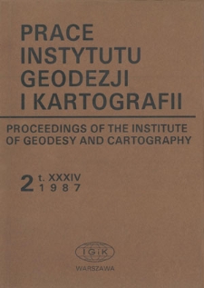
Biblioteka Cyfrowa Instytutu Geodezji i Kartografii contains 1 096 digital objects
Object
Title: Zastosowanie zdjęć satelitarnych Landsat Thematic Mapper do klasyfikacji terenów miejskich
Alternative title:
Application of Landsat Thematic Mapper data to classification of built-up areas
Place of publishing:
Digitisation sponsor:
Publisher:
Instytut Geodezji i Kartografii
Date issued:
Format:
Resource Identifier:
ISSN 0032-6224 ; oai:bc.igik.edu.pl:332
Call number:
Language:
Relation:
Prace Instytutu Geodezji i Kartografii
Is part of:
Access rights:
Dla wszystkich w zakresie dozwolonego użytku
Rights holder:
Instytut Geodezji i Kartografii
Location of original object:
Biblioteka Instytutu Geodezji i Kartografii w Warszawie
Object collections:
Last modified:
Oct 16, 2014
In our library since:
May 7, 2013
Number of object content hits:
1 351
Number of object content views in PDF format
1346
All available object's versions:
http://bc.igik.edu.pl/publication/416
Show description in RDF format:
Show description in OAI-PMH format:
| Edition name | Date |
|---|---|
| Zastosowanie zdjęć satelitarnych Landsat Thematic Mapper do klasyfikacji terenów miejskich | Oct 16, 2014 |
Objects Similar
Zenon F. Poławski Wojciech Bychawski Jerzy Sujecki Maria Iracka Emilia Wiśniewska Tomasz Zawiła-Niedźwiecki Stanisław Dąbrowski Andrzej Zgliński
Bochenek, Zbigniew Ciołkosz, Andrzej Iracka, Maria
Bochenek, Zbigniew
Bochenek, Zbigniew
Kaczyński, Romuald Konieczny, Jacek
Bochenek, Zbigniew
Bochenek, Zbigniew Ciołkosz, Andrzej

